2014.004.156
Map
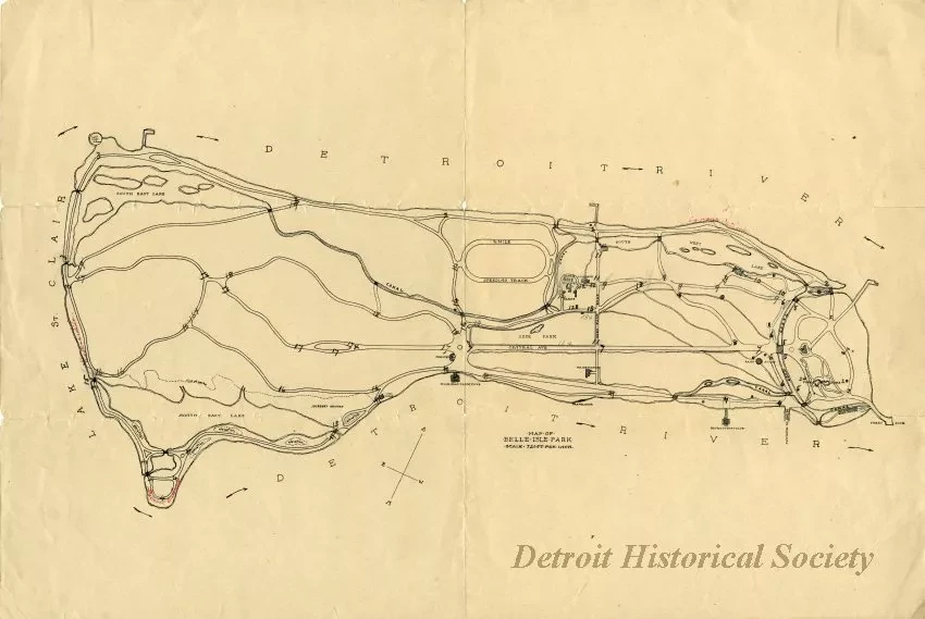
Map of Belle Isle Park
Map, "Map of Belle Isle Park," outline drawing on paper done at a scale of 720 ft. per inch. The map details roads and lakes on Belle Isle, and indicates several c. 1900 landmarks, including the police station, the skating casino, the Casino, the Michigan Yacht Club, the Detroit Boat Club, the half mile speeding track, green houses, band stand, and light house island. "Detroit outlook" is hand written in red on the northeast shore and "Canada Outlook" is hand written in red on the southwest shore. Numbers of unknown significance are handwritten in pencil at various points on the island.
Request Image

