Map
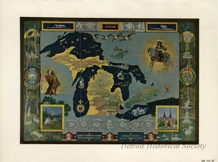
Color print of a map of Michigan, drawn by Frederick J. Wiley in 1923 as a mural in the Children's Room of the Detroit Public Library. Accompanying the print of the map is a sheet of paper with a printed explanatory note, written by Frederick J. Wiley to explain the history represented in the mural. The text of the explanatory note is as follows:
"When the Cadillacs, Campaus and other Frenchmen came to settle in the wilderness which afterward became Michigan they brought with them memories of the beautiful cultivated France they had left, of Louis, 'Le Roi Soleil,' and of the splendors of Versailles which they may have seen.
These things are suggested in the right-hand side of the map, of which the border represents a formal garden with its fountain, swans, sylvan walks and flowers, and on this side of the map, too, is the king on horseback with the rays of a golden sun surrounding him.
The wilderness which the settlers found awaiting them is pictured in the left-hand portion of the composition-the border representing the forest with some of its animals, and near the border an Indian chief with the sun setting behind him in the West.
Among the details used in different parts of the map is the first stockade at Detroit, and the Griffin, which was the first sailing vessel built on the Lakes and which disappeared somewhere in Lake Michigan and was never heard of afterward.
A picture of the old Saint Anne's Church is in the lower right-hand corner, and across the top is a flight of geese which used to be a common sight, spring and fall, fifty years ago."
At the bottom of the map are two Latin mottoes: "Si Quæris Peninsulam Amnam Circumspice" and "Tamen Fit Surculus Arbor."
Request Image

